Hi, sir, I have a question about how data was regrided after spatial-bin in harp. I’m processing another s5p-L2 data which is retrieved from different algorithm, it has different data structure with S5p that harp tool handled. I looked up relevant question on forum and know spatial-bin is average all values in target grid when data don’t have lat/lon -bounds.
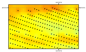
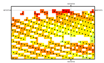
I try to regrid using IDW (interpolate unknow point with a weighted average of nearest 10 points), but it interpolates all area including where has no CH4(Fig. 1, the point is filtered CH4 data), then I choose KDTree method(interpolate unknow point using average of data within a R circle ), but result has too many blank area(Fig.2)
so how do you regrid and get results to avoid too many blank area or don’t interpolate NAN area? Thank you, any suggestions will help.
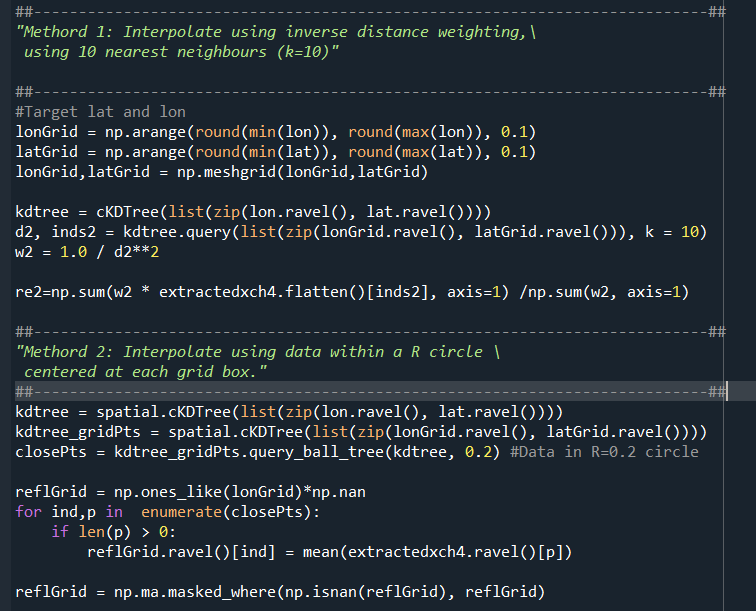
Here is the python code