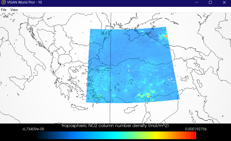
no2_turkey=
harp.import_product(S5P_OFFL_L2__mysateliteimages.nc,
operations=“latitude > ? [degree_north]; latitude < ? [degree_north];
tropospheric_NO2_column_number_density_validity > 75;bin_spatial(?,-?,0.5,?,-
?,0.5)”,
post_operations=“bin(); squash(time, (latitude,longitude))”)
I want to adapt the above command line to cover turkey.
? I couldn’t choose the marks properly
Turkey’s mathematical position; 26°-45° east meridians, 36°- 42° north parallels.
Thank you very much in advance to the expert who will help.