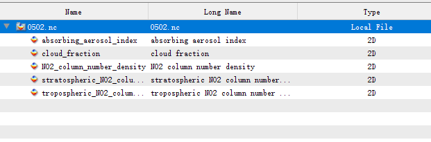
when I use the command to convert a region data to grid L3 data,the outfile netcdf don’t have the longitude and lontitude variable.
harpconvert -a “bin_spatial(301,30.0,0.01,251 ,116,0.01);keep(NO2_column_number_density,tropospheric_NO2_column_number_density, stratospheric_NO2_column_number_density,absorbing_aerosol_index,cloud_fraction)” S5P_OFFL_L2__NO2____20210502T035507_20210502T053637_18398_01_010400_20210503T205946.nc 0502.nc
I had looked the harp document ,but don’t find some useful operation to handle this, So I want to ask,how to write a command ,that can take coordinate as a variable in the netcdf4 file?
Thanks.